


WHAT IS POINTER?
Android Application for cadastral and/or forests maps
Pointer is an Application which allows you to use cadastral and/or forests maps from Bulgarian's ZEM and CAD files on every Android based mobile device with GPS.
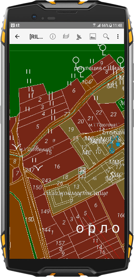
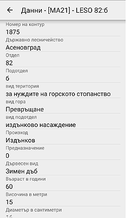
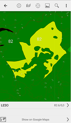
This Application has a Features to visualize of vector and attribute data, to generate thematic maps, Searching and showing data based on different criteria.
HOW IT WORKS?
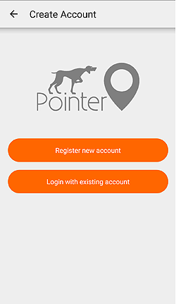
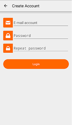
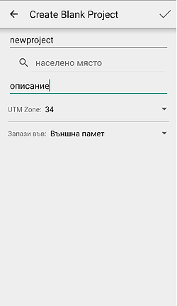
Downloading and install the Demo of the Application from Google Play. Activate application with creating personal Profile in Pointer. You can create Your Profile through mobile Application or from this Registration Form. Store this information tovalidate New Profile. With Your Profile you can use Web Based System of Pointer.
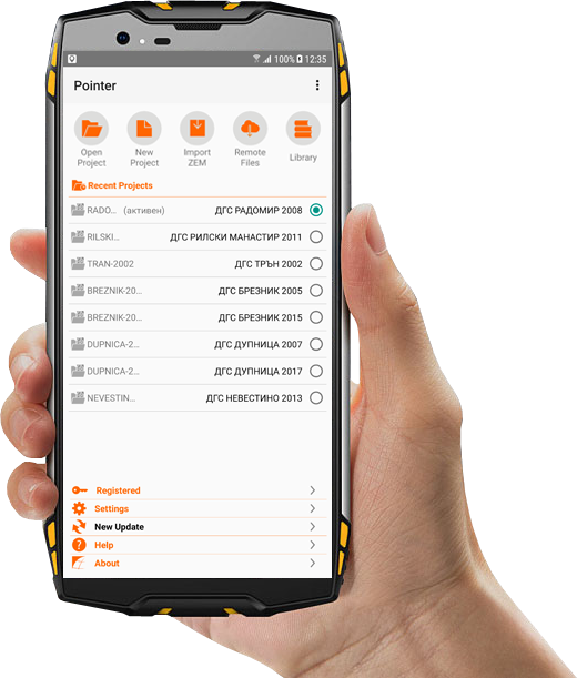
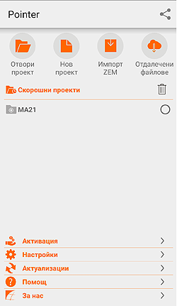
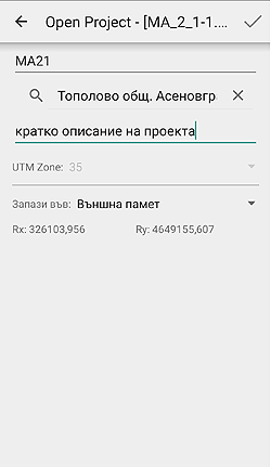
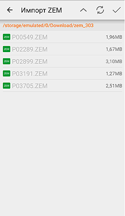
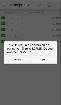
Your maps in CAD and ZEM format will be converted based on his version directly from the mobile device or from Web Based System. Converted data will be automatically downloaded onto mobile device showing in the list of converted projects in the Application.
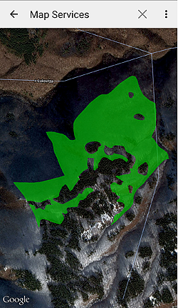
Selecting a project from the list will shows all grahpical data. Activating of GPS will shows your location on the map. The rest of the functions are accessible from context menu.
Uploaded ZEM and CAD files in the profile will be automatically converted to more usefull formats:
• ESRI Shapefile format - allows using of your data in every GIS desktop or mobile system with all of the information in the source files
• MS Excel format - All of the existing data from the source files will be exported in MS Excel format as every sheet will contains single table
FEATURES
-
-
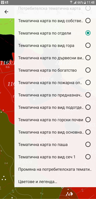
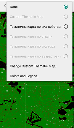
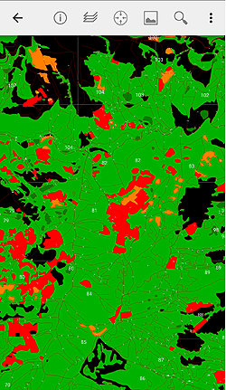
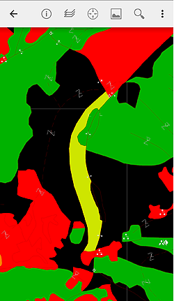
THEMATIC MAPS
• Standard themathic maps
• Making of individual maps
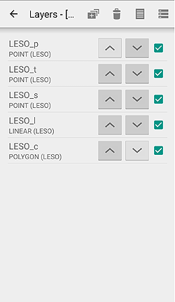
• Layer management based of the type of the graphic objects in it
-
POSITIONING
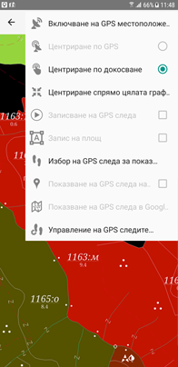
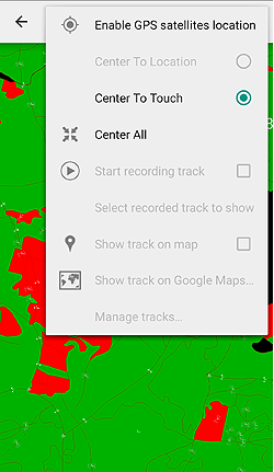
Centering of the maps and pointing with marker current position using GPS and/or GSM positions of the device
-
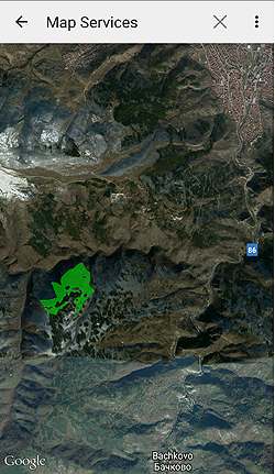
GOOGLE MAPS
• Loading of грапхиц into Google Maps
• Recording of GPS tracks and showing them into the loaded maps or in Google Maps
-
WEB SERVICES
Web based services to transforming, optimizing and storing of mapping data in Pointer, and in different formats ESRI Shapefile and in MS Excel workbooks.
-
-
-
CONVERTING DATA
Support of cadastral and forest data in official in Bulgaria formats:
• ZEM 2.0, 2.10, 2.11, 3.0, 3.01, 3.03
• CAD 1.0, 2.0, 3.0, 4.0
Support for this coordinate systems UTM (WGS84), КС1970 и БГС2005 -
PERFORMANCE
Support custom data format for optimal working performance with mobile devices
-
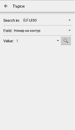
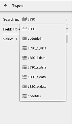
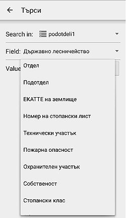
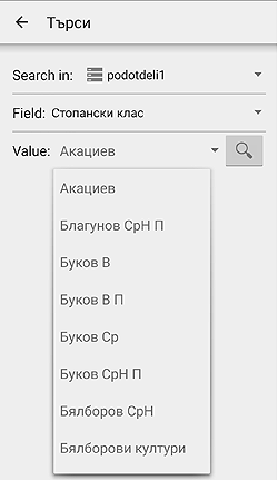
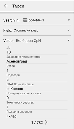
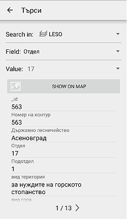
SEARCH
Searching and visualizing graphical and attribute data based on different criteria
-
SHARING DATA
Sharing data with other devices by an email or Bluetooth directly from the mobile device
-
SCREENSHOTS

VERSIONS
The variety of requirements and needs of our current and future clients and partners, to the functionality of the Pointer application, has made us profiling the product to different versions of it. The base version of the Pointer application is well known among forestry specialists. With its help, each client can use their own ZEM and CAD data on any mobile GPS device with Android OS. It is well known among students, students at the University of Forestry - Sofia, the version of POINTER EDU, which is available free of charge from Google Play. The application aim is to support the practical training of students and is fully functional for the forests of Jundola and Barzia.
Coming soon Pointer Lib is the latest version of the application Pointer. This is a profiled version that allows everyones to have access to the entire resource of forests land plans in use in the country as it is available on the site of the Executive Forest Agency. In addition to all graphical information about the forest areas - every subdivisions of the land, will be available and forests types, soils, slopes, land purpose and all of the trees indicators, presented in a similar manner to the taxation form description.
HOW TO BUY
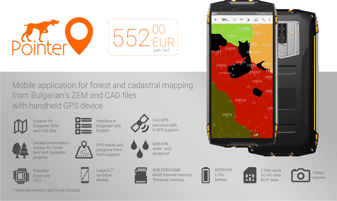
Current price for fully functional licensed application is 185 EUR. (VAT Included). You can follow these steps to use this application on your device: 1. Make an installation of the Demo of the Application from Google Play to check that your device is fully compatible with this Application. There is a free pre-installed project to shows you how to use the data in our application. 2. Register your own profile in our platform using menu Activation. You will receive an email on your registered email address with the payment information. Updates are free unless there are not included a services with an additional payment. 3. Make your payment. 4. After clear payment (the money are in our bank account) menu Actualizations will become a New Update and will shows up active URL pointing to the full version of the application. So that's all!
PACKAGE PRICE
MOBILE DEVICE WITH PRE-INSTALLED APPLICATION
DOWNLOAD


CONTACTS
-

XIMAPS LTD
1575 Sofia
D-r Stoyan Chomakov Str. 4a -
 +359 877 946 277
+359 889 886 667
-
 ximaps (at) gmail.com